
The landscape surrounding
Laurel Ridge Nature Reserve tells a story that reaches back thousands of years.
Long before Whitehall Reservoir existed in its present form, water, wetlands
and forests shaped this corner of Hopkinton. Over the centuries, people
repeatedly changed that landscape — first by indigenous people, then for settlement and waterpower, later
for industry and metropolitan water supply, and ultimately for conservation.
Today, at Laurel Ridge,
another chapter is being written: one focused on protecting what remains and
restoring some of the native character of the landscape that came before. Beyond their ecological importance, forests also offer something restorative that benefits human emotional and physical wellness.
History has helped guide our stewardship of Laurel Ridge. In selected areas of the reserve, we are reforesting previously disturbed land with native species characteristic of the historic Whitehall–Cedar Swamp landscape — including Atlantic white cedar, red or swamp maple, black gum or tupelo, eastern hemlock, Mountain laurel and blueberries, and other native trees and shrubs.
These choices are intentional. Nearb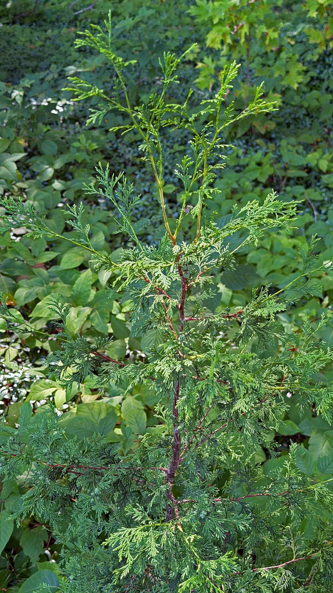 y Cedar Swamp — named for its uncommon Atlantic white cedar community — also contains important Red Maple–Black Gum swamp communities, while these and other native species have long been part of the forests and wetlands of the greater Whitehall landscape.
Atlantic white cedars (Chamaecyparis thyoides) still line portions of the Whitehall Reservoir shoreline and used to be widespread through the now-flooded Whitehall marshlands, while red or swamp maples thrive in the moist soils characteristic of the Whitehall watershed. Black gum, or tupelo (Nyssa sylvatica), has an especially strong connection to this landscape: nearby Cedar Swamp supports an important Red Maple–Black Gum Swamp natural community, a distinctive wetland forest type found in Massachusetts. Individual black gums are remarkably long-lived, with some surviving for more than 500 years. Tupelos contribute food and habitat for wildlife while flourishing in wetland margins and low forests. Eastern hemlock adds another important native evergreen component to the woodland canopy.
Atlantic white cedar has a particularly important place in the ecology and history of the Whitehall–Cedar Swamp landscape. It forms distinctive swamp forests characterized by shallow pools and raised mounds, or hummocks, around the trees. These complex wetlands provide valuable habitat: birds and mammals use the evergreen canopy for nesting and shelter; amphibians and insects depend on the pools and saturated soils; and turtles use the hummocks for nesting and refuge.
Slow-growing and remarkably long-lived, Atlantic white cedars can persist for centuries, forming dense, cathedral-like evergreen stands. Their fragrant blue-green foliage and distinctive forest communities have long been part of the character of Whitehall and Cedar Swamp, while the species also has cultural and traditional importance to Indigenous peoples. Restoring Atlantic white cedar at Laurel Ridge therefore represents more than planting a native tree — it helps reconnect the reserve with an ancient wetland forest community that has defined this landscape for generations.
At Laur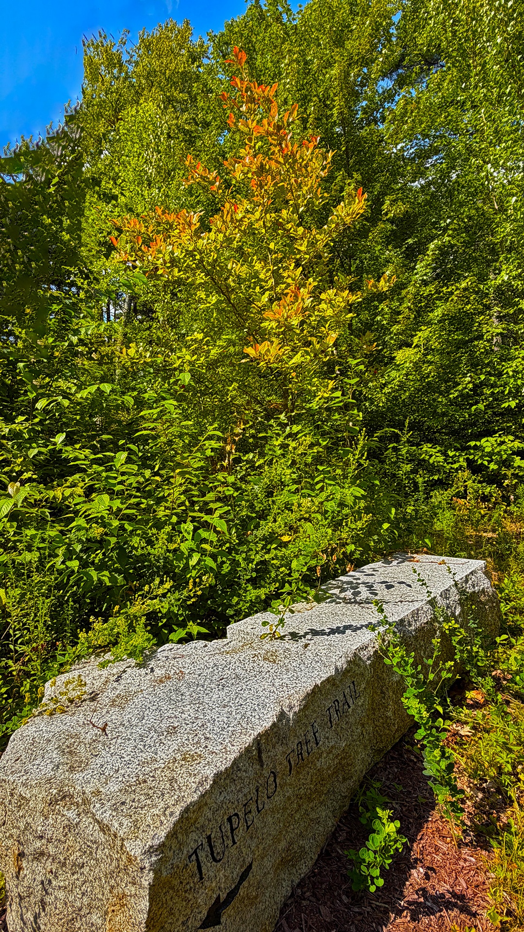 el Ridge, that connection is reflected in Tupelo Tree Trail, a short trail segment
where tupelos have been planted as part of the reserve's native reforestation
effort. The trail's name recognizes both the species and its historic
ecological connection to the Whitehall–Cedar Swamp landscape.
el Ridge, that connection is reflected in Tupelo Tree Trail, a short trail segment
where tupelos have been planted as part of the reserve's native reforestation
effort. The trail's name recognizes both the species and its historic
ecological connection to the Whitehall–Cedar Swamp landscape.
Together, these species do more than reforest previously disturbed ground. They help reintroduce elements of the native forest communities historically associated with Whitehall and Cedar Swamp, increasing biological diversity, strengthening wildlife habitat, protecting soils and water quality, and connecting Laurel Ridge ecologically with the larger protected landscape surrounding Whitehall.
Our goal is not to recreate a vanished ecosystem, but to restore some of its native character while strengthening the natural systems that sustain it.
To understand why these
trees belong here — and why their restoration matters — it helps to understand
the remarkable landscape that preceded today's Whitehall Reservoir.
The Whitehall landscape was shaped by glaciers, which left behind the ridges, depressions, streams, ponds and extensive wetlands that still characterize the region. Whitehall Brook flows north toward Cedar Swamp, part of the headwaters of the Sudbury River system.
Cedar Swamp remains one of the region's most important wetland landscapes. Massachusetts designated it the Commonwealth's first Area of Critical Environmental Concern in 1975. The approximately 1,650-acre ACEC consists primarily of vegetated wetlands and includes the uncommon Atlantic white cedar swamp from which it takes its name. Its wetlands provide important wildlife habitat, flood storage and protection for the headwaters of the Sudbury River.
The broader Cedar Swamp landscape also has a much older human history. Archaeological evidence demonstrates Indigenous use of this area extending back thousands of years. Long before European settlement, its wetlands, forests, streams and uplands provided food, water, travel corridors and other resources.
Forests are vital ecosystems providing oxygen, habitat, and resources for wildlife.
European settlers quickly recognized another value in the Whitehall landscape: waterpower.
In 1705, John Wood married Elizabeth Buckminster, daughter of Colonel Joseph Buckminster of Framingham. Wood and Elnathan Allen of Sudbury subsequently acquired extensive acreage near Cedar Swamp, eventually adding another tract and a sawmill to their holdings.
Historical accounts place early milling activity on Whitehall Brook by the second decade of the 18th century. By the early 1700s, Whitehall Pond and its outlet were being used to power mills — beginning a relationship between water and industry that would shape the community for nearly two centuries.
The settlement that developed around these activities eventually became Woodville, named for the Wood family.
Whitehall was then very different from the lake we know today. Historical descriptions portray a considerably smaller Whitehall Pond surrounded by farms, forests and extensive wetlands and cedar swamp. By the 19th century, successive dams and industrial uses had increasingly altered the natural water system.
Waterpower transformed Woodville.
By the early 19th century, larger manufacturing enterprises had joined the earlier mills. The Hopkinton Cotton Manufacturing Company began operating near the lower Whitehall dam in 1811, and Woodville developed into an active industrial village.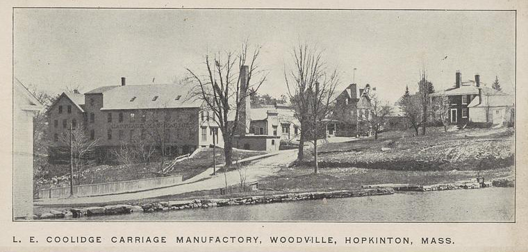
Over the ensuing decades, mills and factories produced textiles, shoes and other goods. Homes, shops and community institutions grew around them. Whitehall Pond was no longer simply a natural feature; its waters had become an important source of economic power.
Yet the same water that sustained Woodville's industries would eventually bring about their disappearance.
By the latter half of the 19th century, metropolitan Boston was confronting an increasingly urgent problem: securing enough clean drinking water for its rapidly growing population.
Chapter 177 of the Massachusetts Acts of 1872 authorized the City of Boston to obtain additional water supplies from the Sudbury River watershed. Over the following decades, Boston acquired extensive lands and water rights throughout the region and constructed a network of reservoirs, dams and aqueducts.
Whitehall became part of that enormous undertaking.
The transformation was not a single event or a single "taking," as the history is sometimes summarized. It occurred through a sequence of land acquisitions, takings, engineering projects and transfers of ownership during the late 19th century.
The surviving land records provide an unusually detailed glimpse into this transformation.
In an instrument dated July 29, 1890, identified as Taking No. 21 under the autho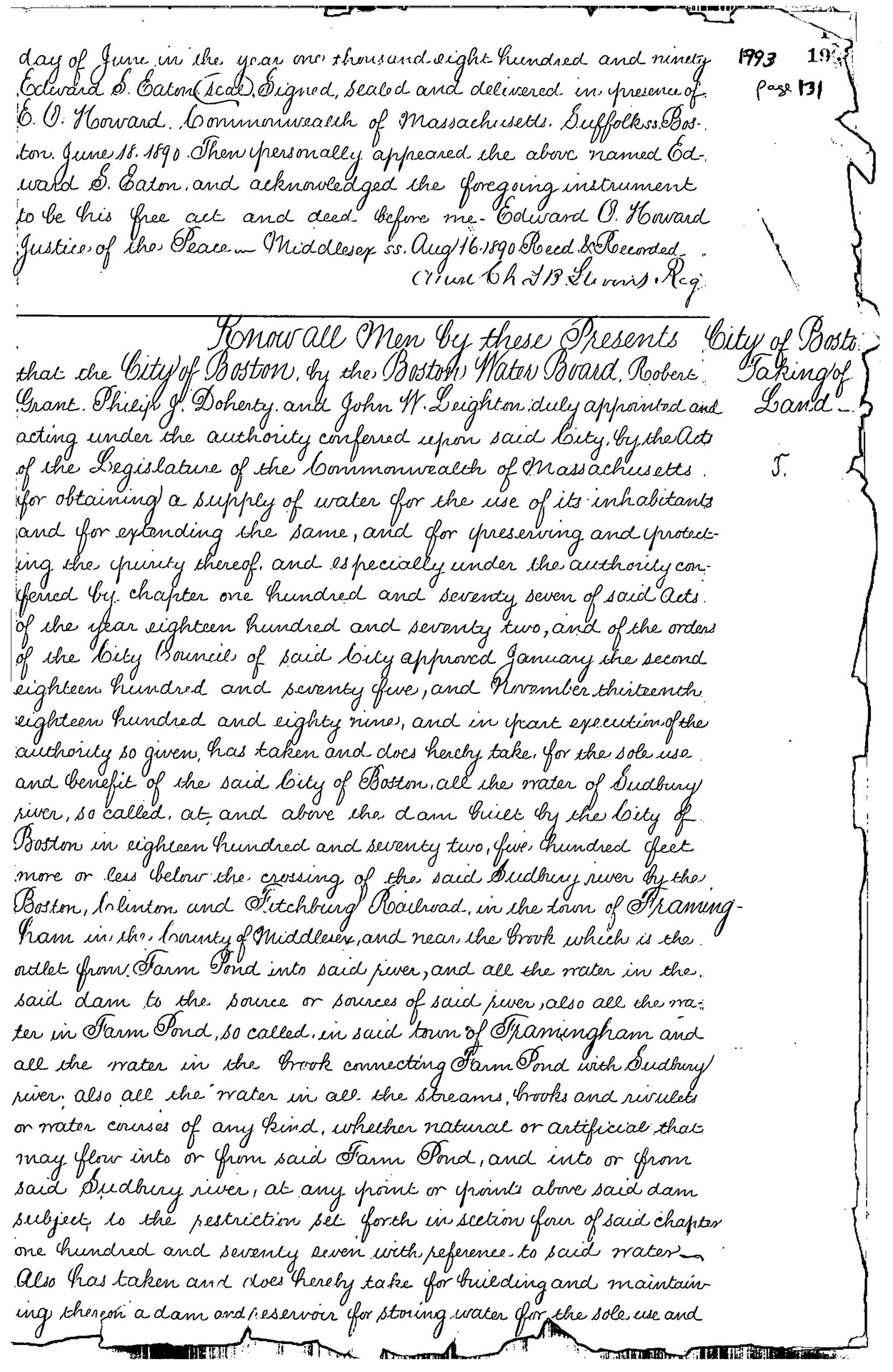 rity originating with the Sudbury River Act, the City of Boston took interests in lands around Whitehall, including a portion of property belonging to George F. Adams.
A subsequent taking of Adams's land was recorded on March 16, 1892 at the Middlesex Registry of Deeds.
That taking created a practical problem: it severed the existing means of access between Adams's remaining land on the Whitehall peninsula — then described as part of the "Point lot" — and Wood Street.
The City of Boston therefore reached a settlement with Adams.
On March 26, 1892, Boston agreed to provide Adams, his heirs and assigns, with the right to use a 15-foot-wide way connecting his remaining property with the nearest road.
That right-of-way is the historical origin of what became Piazza Lane, which continues to provide access to the peninsula more than 130 years later.
The story of Piazza Lane is therefore inseparable from the creation of the Whitehall Reservoir water-supply landscape: the road exists because Boston's acquisition of lands around Whitehall separated the remaining private peninsula from its former access.
The regional water system changed hands again only a few years late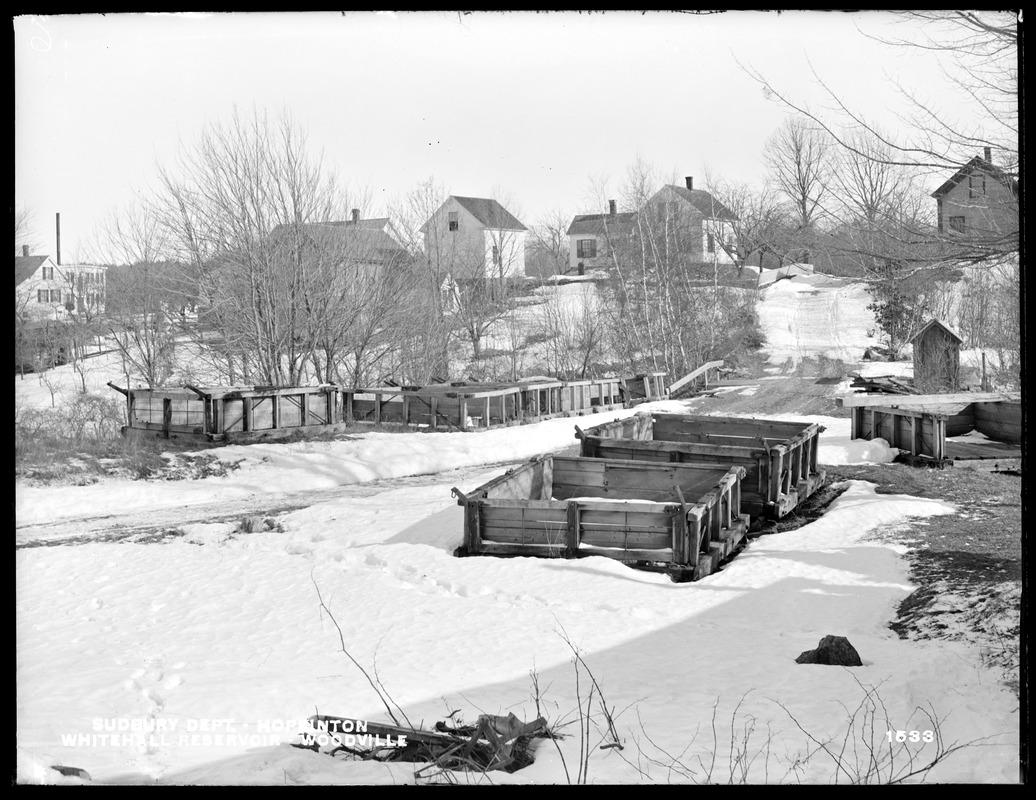 r.
r.
Under Chapter 488 of the Acts of 1895, the newly created Metropolitan Water Board acquired the City of Boston's property, rights, easements and interests associated with the metropolitan water system.
By the end of the decade, Whitehall had been substantially transformed.
Metropolitan Water Works plans dated December 31, 1897, entitled Cedar Swamp and Whitehall Pond – Land Plans, document the lands surrounding the developing water system. Surviving maps from this series remain in historical archives today.
By 1898, Metropolitan Water Board photographs documented Whitehall Reservoir and associated dams, houses, workshops and waterworks infrastructure that flooded acres of pre-existing swamp and other lowlands.
The smaller Whitehall Pond, wetlands and surrounding lowlands had become part of a substantially enlarged water-supply landscape.
Protecting drinking water also meant eliminating sources of pollution.
Factories and other industrial operations around Whitehall Reservoir were no longer compatible with Boston's water-supply objectives. Industries closed or relocated, fundamentally changing the economy and physical character of Woodville. Historical accounts identify 1894 as a pivotal year in that transition.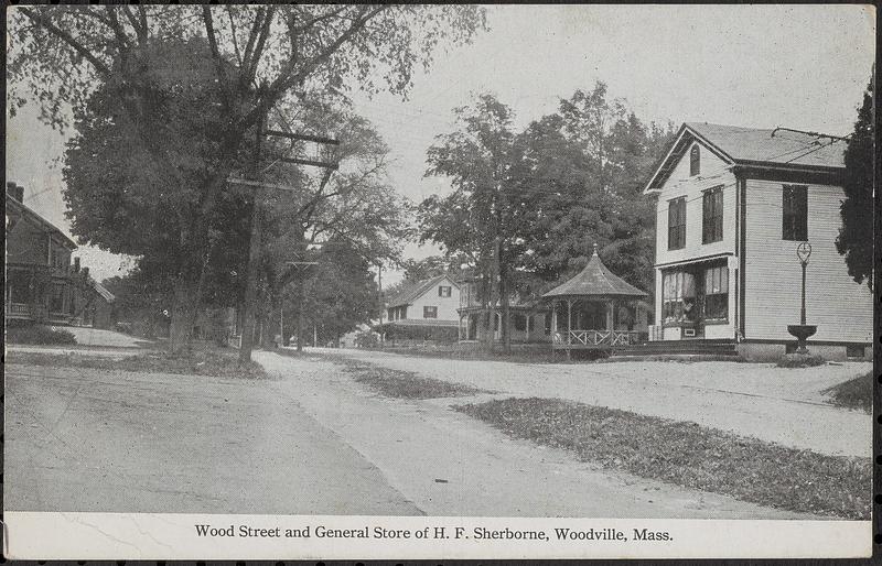
Then, in 1909, a major fire destroyed many of the remaining industrial buildings around Whitehall Reservoir.
Within only a few decades, the landscape had changed from an active mill and manufacturing center into something entirely different: a protected water-supply watershed.
Nature gradually began reclaiming the former industrial landscape.
As metropolitan Boston developed larger water sources — ultimately including Wachusett and Quabbin — some of the earlier reservoirs became less important to the metropolitan drinking-water system.
Whitehall Reservoir eventually entered another phase of its history: conservation and recreation.
The forests returned. Wetlands persisted around the reservoir. Wildlife reclaimed shorelines once occupied by mills, houses and industrial buildings.
Today, Whitehall Reservoir and the surrounding protected lands form an extensive interconnected natural landscape of water, forest, wetlands and wildlife habitat.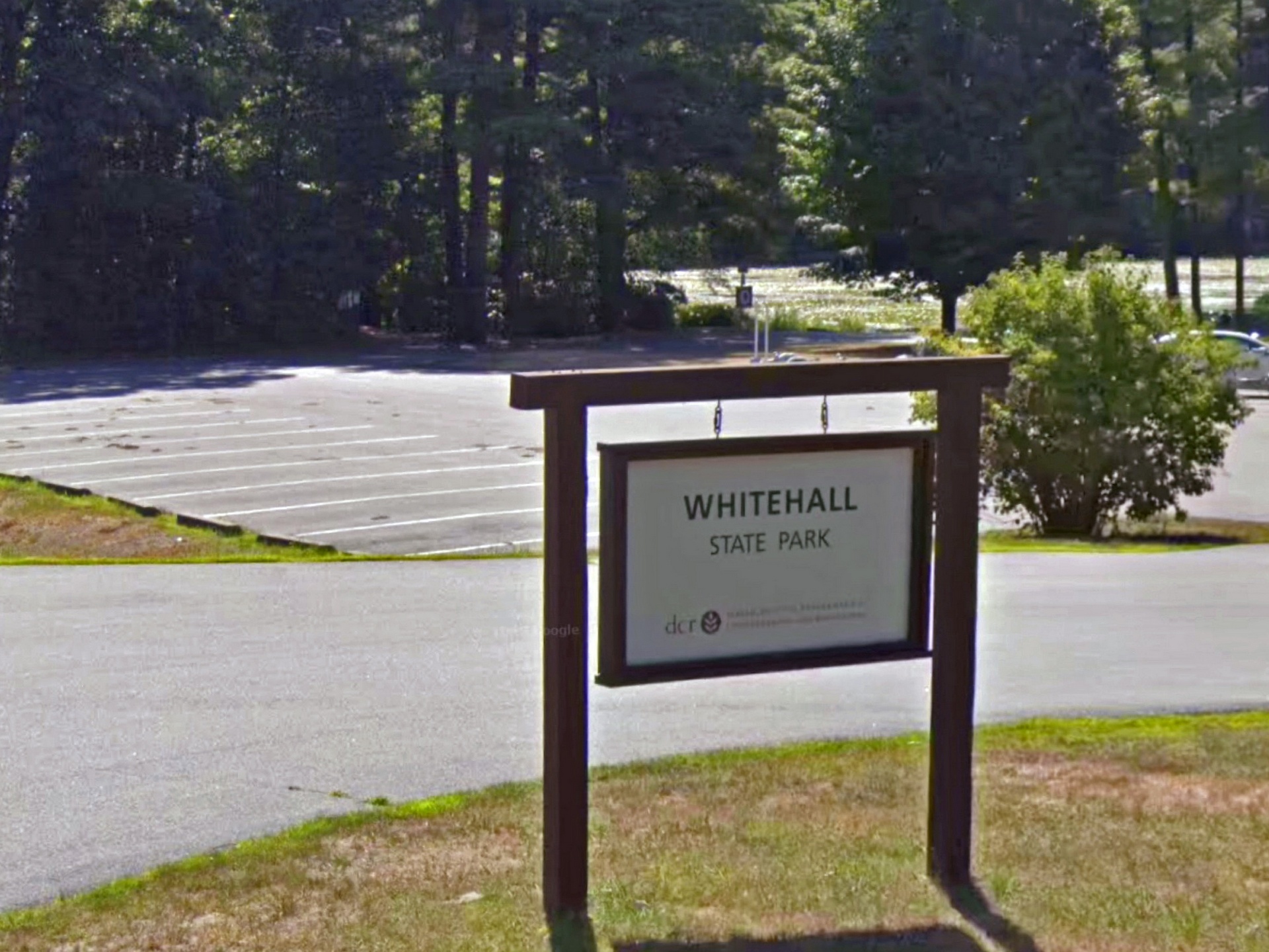
As mentioned earlier, the ecological importance of those precious natural landscapes of forests, wetlands and wildlife habitats have been formally recognized. Cedar Swamp became Massachusetts' first Area of Critical Environmental Concern in 1975, and modern BioMap conservation mapping identifies important Core Habitat and Critical Natural Landscape throughout portions of the greater Whitehall area.
The Commonwealth, through the Department of Conservation and Recreation, also protects Whitehall Reservoir as Whitehall State Park, with an extensive buffer of protected state land surrounding the shoreline.
Laurel Ridge Nature Reserve occupies part of this remarkable landscape on a forested peninsula overlooking Whitehall Reservoir.
Its conservation represents another transformation — but this time the objective is not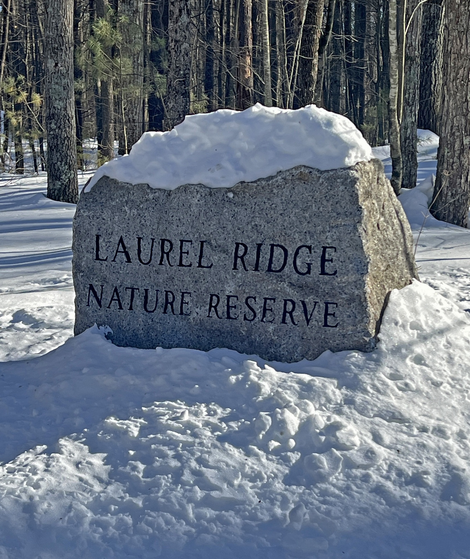 to change the landscape for human use. It is to protect and restore it for future generations.
Approximately 20.5 acres at Laurel Ridge are permanently protected through a Conservation Restriction held by Sudbury Valley Trustees. The reserve protects forest, wetlands, wildlife habitat, watershed resources, scenic ridgelines and approximately two miles of trails.
The native reforestation described at the beginning of this history is part of that stewardship. By returning Atlantic white cedar, red and swamp maple, black gum or tupelo, eastern hemlock and other native species to previously disturbed areas, we hope to reconnect portions of Laurel Ridge with the native forest communities historically associated with Whitehall and Cedar Swamp.
Together, permanent protection and ecological restoration allow the history of this landscape to inform its future.
The value of forests extends beyond wildlife habitat, biodiversity and watershed protection. A growing body of research has found that spending time in forests and other natural environments can benefit human physical and emotional well-being, including reducing stress and encouraging relaxation and restoration.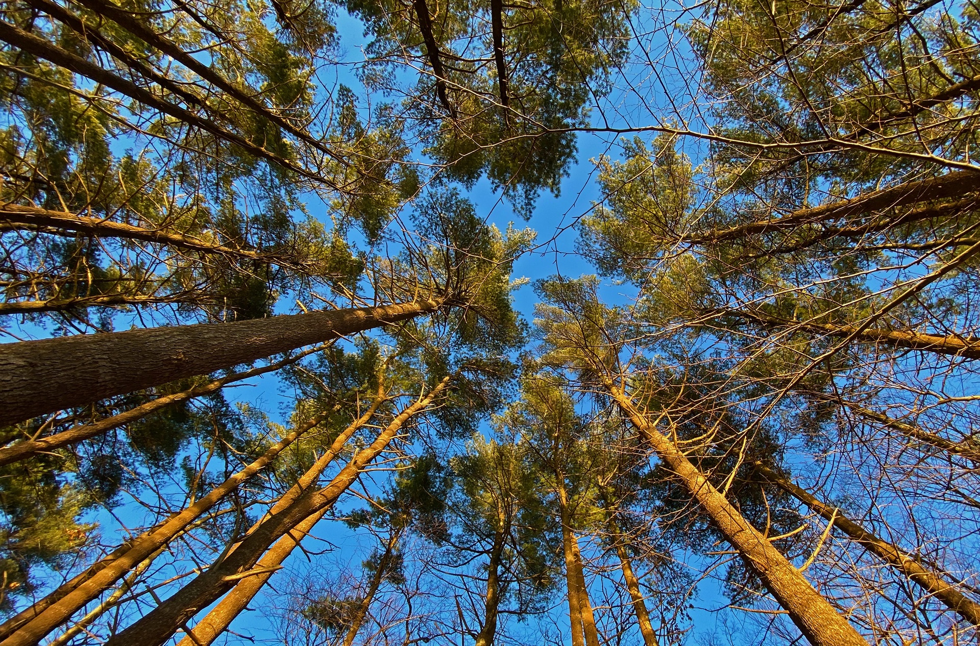
Cultures around the world have long recognized this connection between people and the natural world. In Japan, the practice known as shinrin-yoku, or “forest bathing,” encourages quiet, unhurried time among trees—not as exercise or a destination to be reached, but simply as an opportunity to experience the forest through the senses.
Perhaps that is another reason places like Laurel Ridge matter. Protecting a forest preserves not only habitat for the creatures that live there, but a place where people can slow down, reconnect with nature, and experience the quiet sense of well-being that forests have offered for generations.
For thousands of years, people have lived within and traveled through the greater Whitehall–Cedar Swamp landscape. Archaeological evidence documents Indigenous use of the region long before European settlement, when its wetlands, forests, streams and uplands provided food, water, travel corridors and other resources.
Over the last three centuries, the forests and waters of Whitehall have continued to shape the lives of those living around them. The earliest European settlers looked to Whitehall Pond and its forests for timber and waterpower. Later generations harnessed those waters for manufacturing. Boston transformed the landscape again in its search for drinking water. Eventually, the same watershed came to be valued for conservation, wildlife and recreation.
Today we understand something our predecessors could not fully appreciate: forests, wetlands, wildlife and clean water are not separate resources. They are parts of one interconnected natura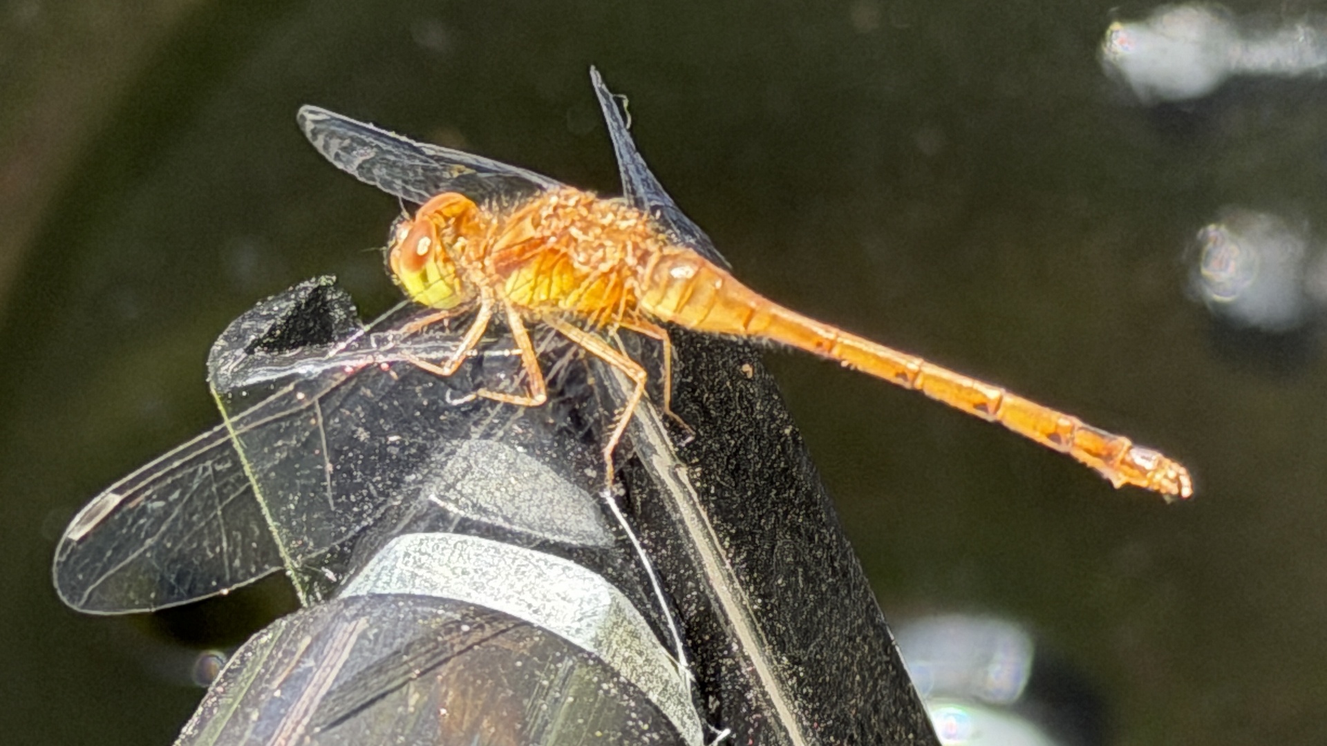 l ecosystem.
That understanding guides the stewardship of Laurel Ridge.
The newest chapter in Whitehall's long history is therefore not about taking something from the landscape.
It is about giving something back.
Our goal is not to recreate the landscape of the past, but to preserve what remains and help some of its native character return.